

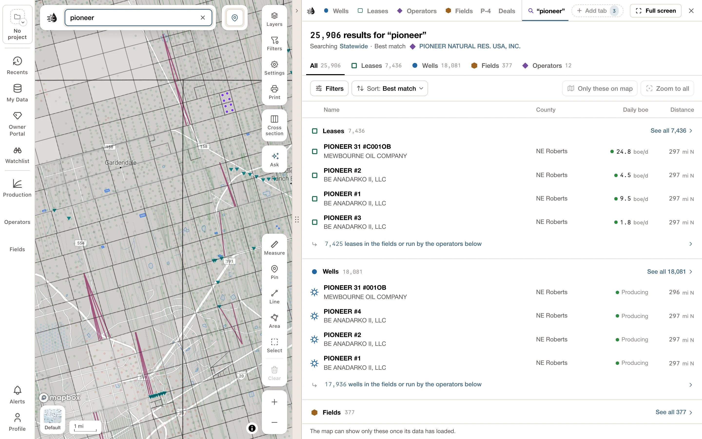
The heading
- The count: 128 results for “chisholm”, or 40 leases for “chisholm” on a type tab. A + after the number means there were too many wells to count.
- Where it searches: Searching Statewide. Click Statewide to search only the part of the map you can see now; the line then reads Searching the map area, and clicking the map area searches all of Texas again. A county, a circle or an area you drew is named instead, such as Searching Dickens County.
- The best match: Best match, then the mark and name of the record QuickScout thinks you were after, such as a producing operator whose name starts with your words, or the busiest producing lease on screen. Click its name to open it the way its row does. Its row in the list says Best match too.
Type tabs
Under the heading: All, Leases, Wells, Fields and Operators, each with how many it holds. A tab with nothing in it is greyed out.All
Four sections, in the same order as the search panel: Leases, Wells, Fields and Operators. Each lists its first few results, the ones named for your words first. See all and the section’s count, such as See all 115, opens that type’s tab. Big counts are explained under the rows. A search for chisholm may find 115 leases of which only 24 are called Chisholm; the line under them then reads 91 leases run by the operators below. Click the line to open the Leases tab at those 91. Other lines say … in the fields below, … in the fields or run by the operators below, … that match on another column, and under Fields, … fields of the leases above.Leases and Wells
Each lists everything All counted for it, in two lists:- Named “‹words›”: the ones whose own name has your words.
- Not named “‹words›”: the ones that matched another way. A line under the heading says how, such as Matched on their operator., Matched on their field. or Matched on another detail (county or number).
Fields and Operators
- Fields lists every field holding a lease your words matched. Fields named for your words come first; the rest follow under Not named “‹words›”, with a line such as Matched on their leases’ operators. Each field says how many of its leases matched, such as 8 of 15 leases.
- Operators lists the operators whose names have your words.
What a row shows
- The record’s mark, the same symbol it has on the map, then its name. The best match says Best match after its name, and a record in your compare tray says In compare.
- Under the name, where it is and who runs it: the part of its county and its operator (NE Schleicher · …). Fields and operators show their leases (61 leases).
- On the right, what it makes today in boe/d (oil plus gas, 6 mcf to the barrel), or its status, such as Not producing. On the Wells tab, a producing well shows its lease’s rate, because Texas reports production by lease; elsewhere a well shows its status, such as Producing.
- How far it is from the middle of your view, and which way, such as 4 mi NE. The distance is highlighted when the record is on screen, and updates as you move the map.
Open, drill down and go back
- Click a well to open its card.
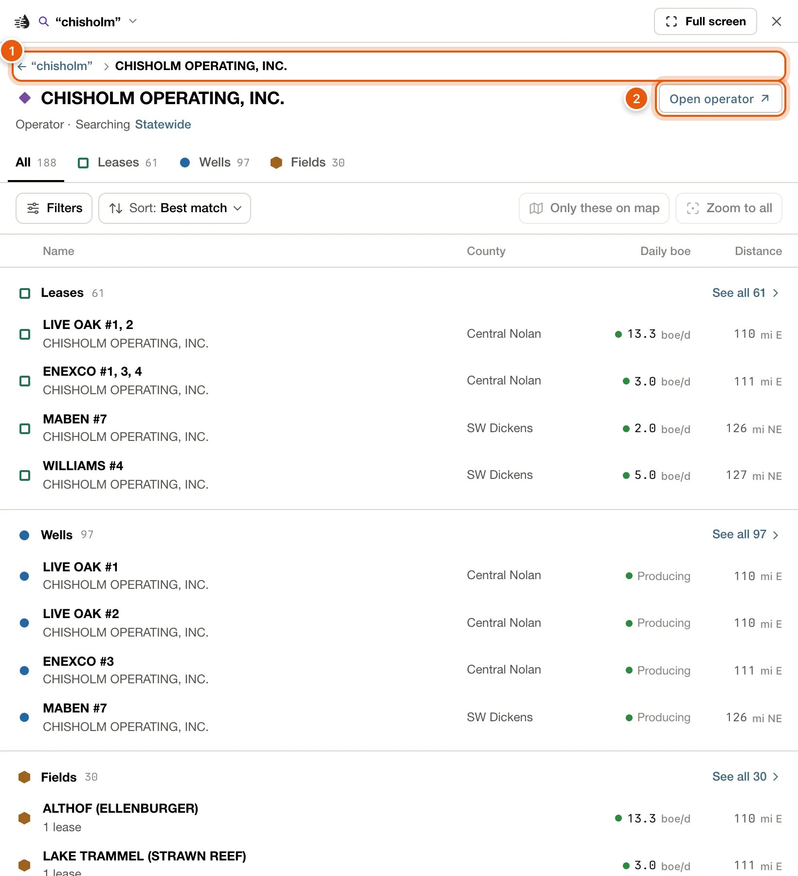
- Click an operator, field or lease to drill down into what it holds: an operator’s leases, wells and fields; a field’s leases, wells and operators; a lease’s wells. The type tabs change to the kinds it holds.
- To open its card instead, hover the row and click Open operator, Open field or Open lease at its right end, or hold ⇧ and click the row.
Narrow the results
Click Filters, under the type tabs. Each tab has its own:- Tick a value to keep only those results. Each value says how many results it would leave. Ticking two values in one filter keeps either one; ticks in different filters narrow each other.
- A long list shows its top five; Show all and its count lists the rest. The box at the top, such as Find a county, operator or field…, finds a value in every filter at once.
- Status is Producing or Not producing. Daily boe comes in bands from 1,000+ boe/d down to Under 10 boe/d and No current rate.
- Last produced (Wells) has a bar for each year. Click a bar, or drag across several for a range.
- Area is one of Statewide, In current map view, Within 50 mi of map center, Within 100 mi of map center and An area you draw on the map. A map view or circle is fixed when you pick it; moving the map afterwards doesn’t change it.
These filters belong to the search. Your own Wells and Leases filters, and the map’s Filters card, aren’t changed.
Draw an area
Choose An area you draw on the map under Area. Click the map to place each corner, then double-click to finish. While you draw, clicking the map doesn’t open wells; Esc gives up. The results narrow to the area. A dashed violet outline marks it on the map, its chip reads Drawn area, and the heading says Searching the area you drew. Click the chip’s × to remove it. The outline narrows only this search. To gather everything inside an area of the map on one card, use Select an area instead.Walkthrough: producing leases in an area, by rate
1
Search, then open the Leases tab
Search for a name, such as pioneer, and press Enter. On the Search tab, click Leases.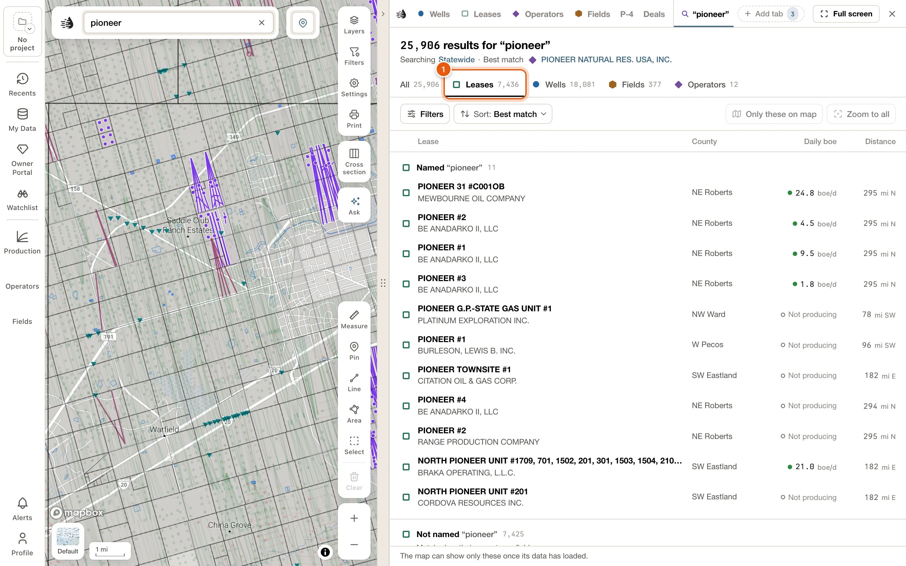
2
Keep only producing leases
Click Filters. Under Status, tick Producing. The list and its count update at once.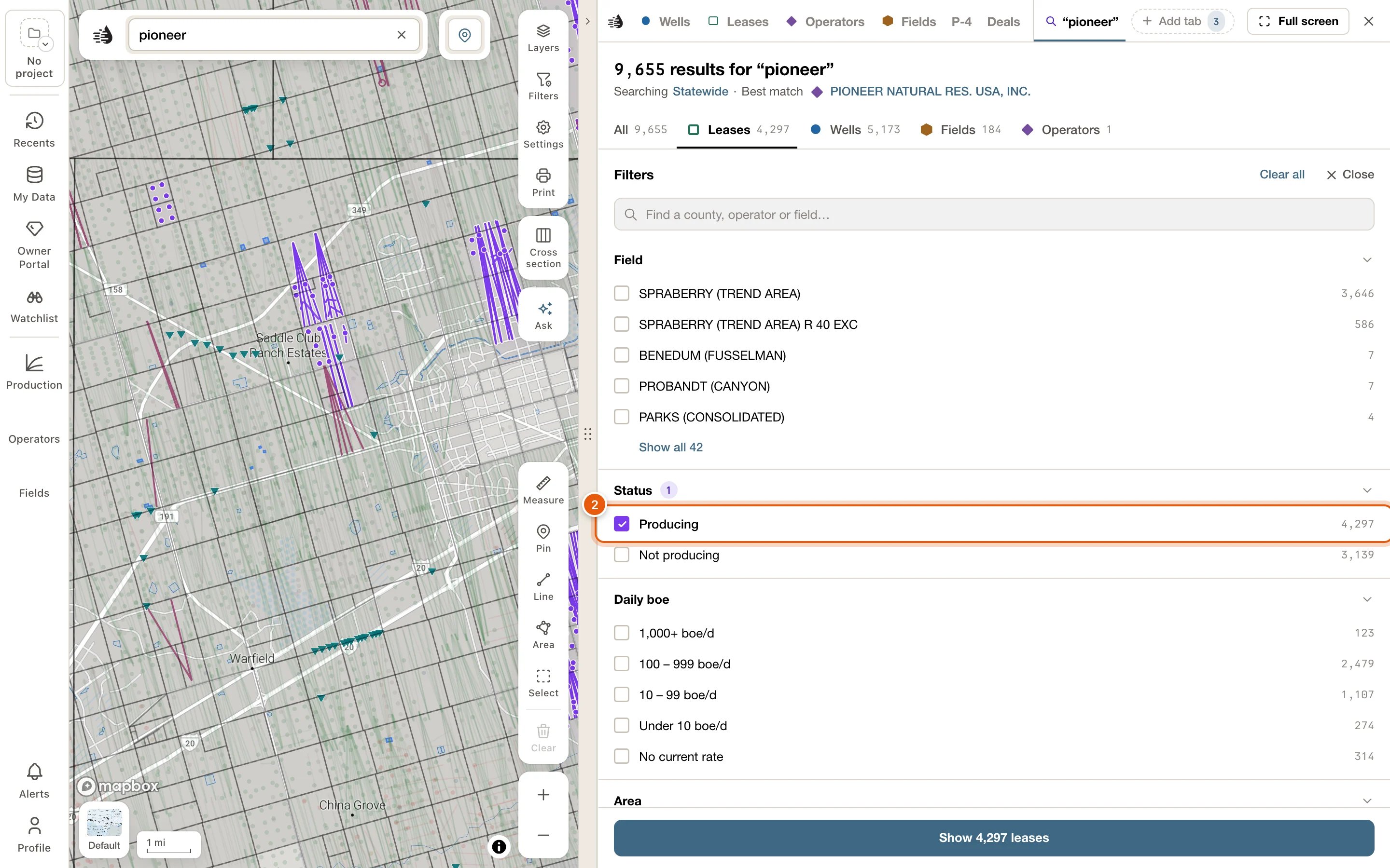
3
Draw your area
Under Area, choose An area you draw on the map. Click the map at each corner, then double-click to finish.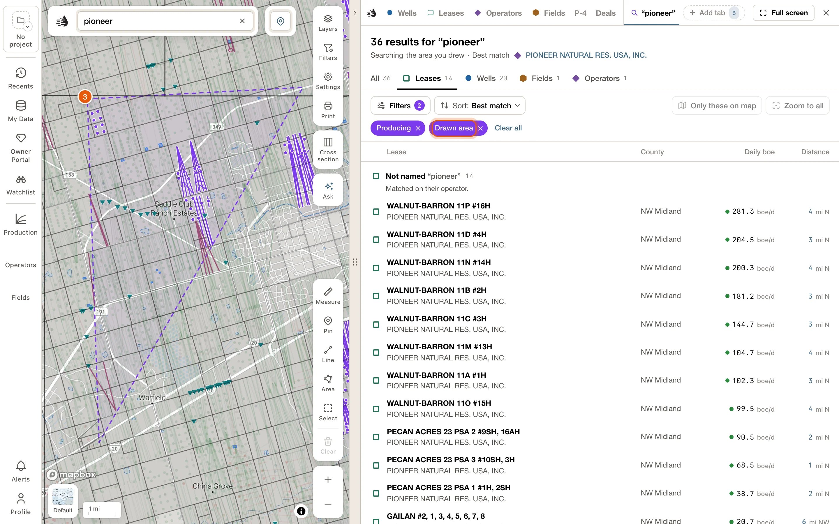
4
Sort by today's rate
Click Sort, choose Daily boe, and keep High to low. The busiest leases are now at the top.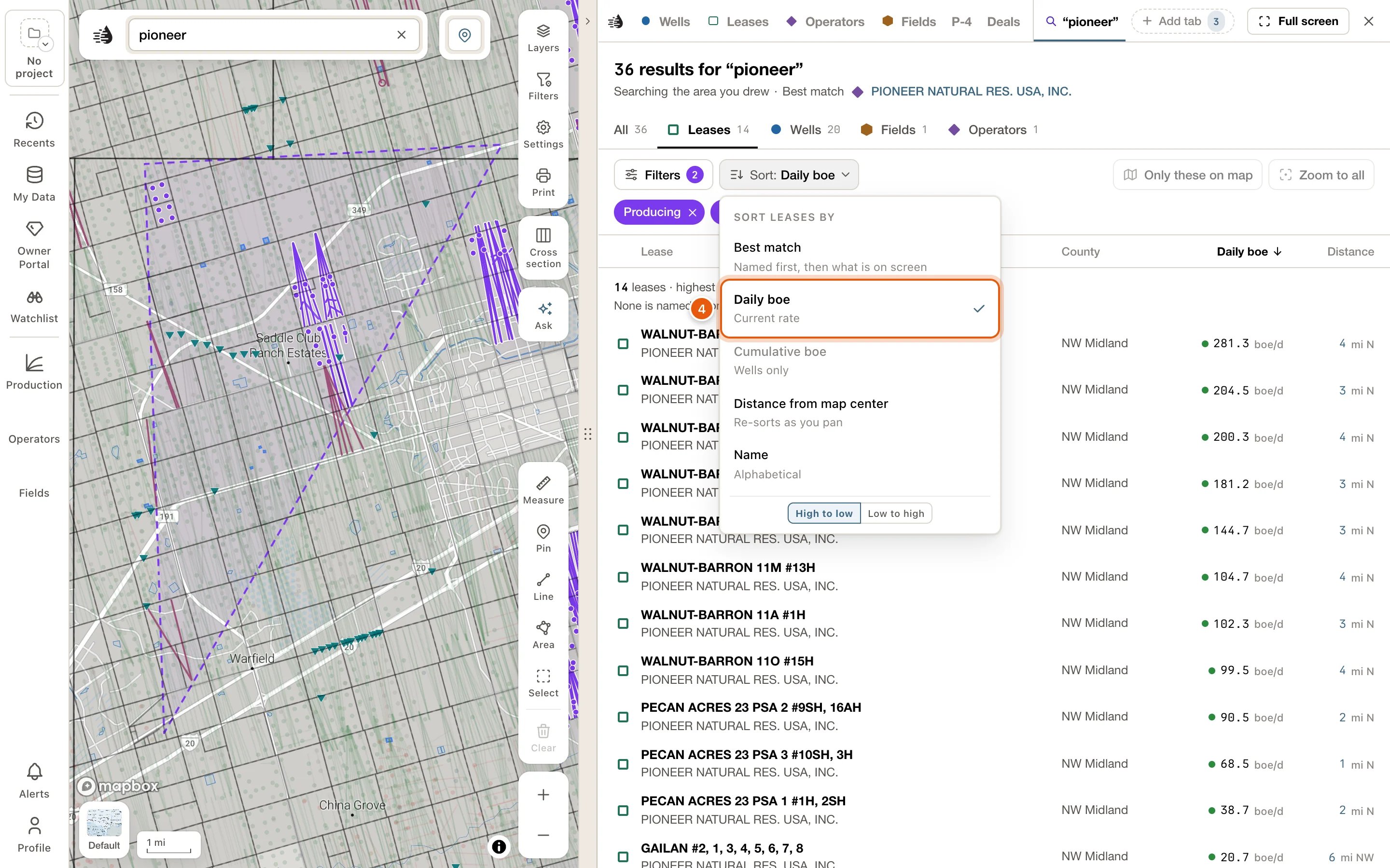
5
Show only these on the map
Click Only these on map. Every other well is hidden, so only these leases’ wells are drawn. Click Zoom to all to frame them.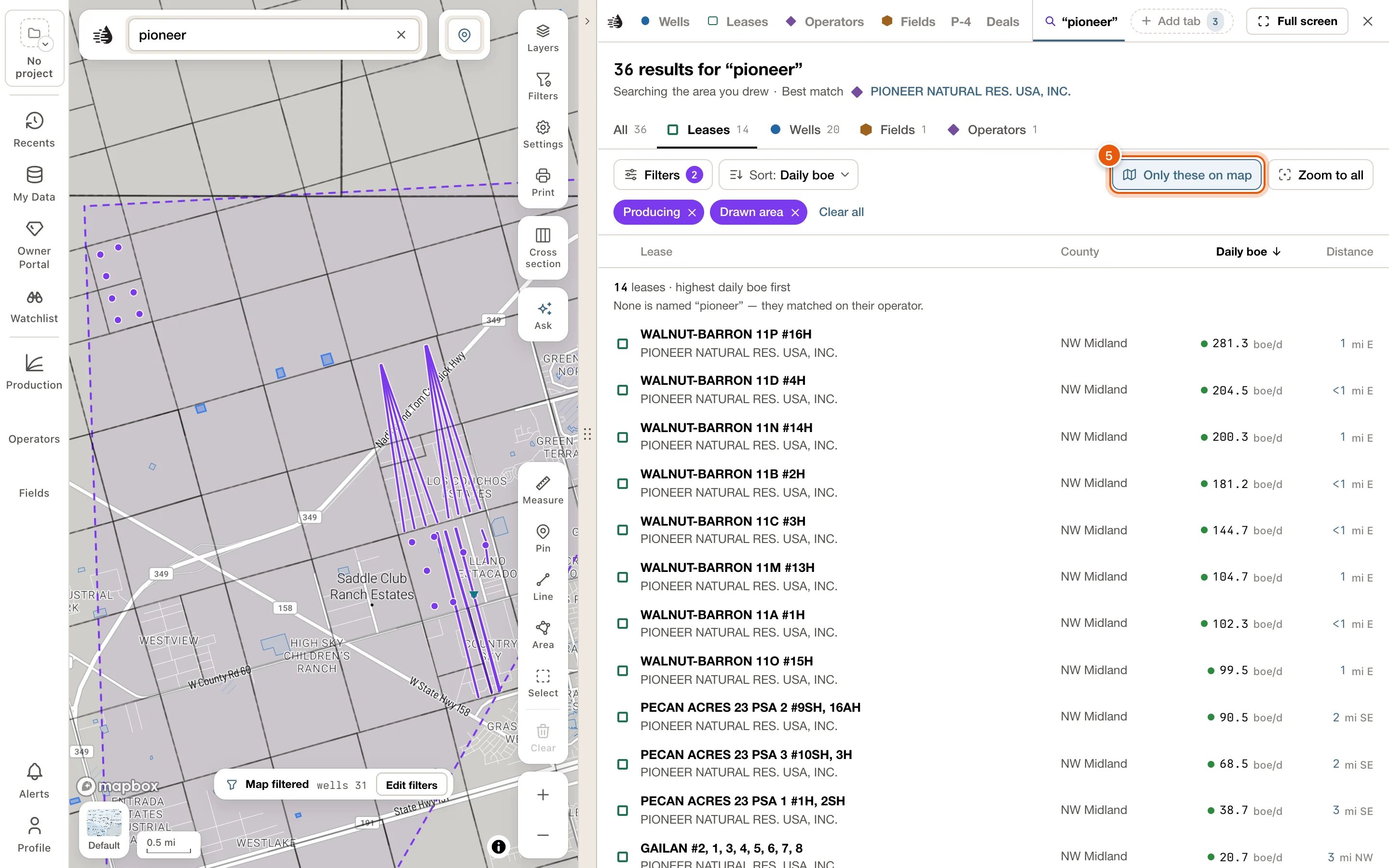
Sort
Click Sort. The button says the order in force, such as Sort: Best match.
On a type tab, any order but Best match makes one ranked list, with a line over it saying what it is, such as 228 leases · highest daily boe first. A line under that says how many are named for your words and how the rest matched. On All, each section lists its first few in that order.
On the map
The matches are always drawn in violet on the map; see While a search is on. The Search tab adds two buttons at the right end of its toolbar:- Only these on map hides every other well, so only the search’s wells are drawn. Click it again to bring the other wells back. It works for up to 30,000 wells; narrow a bigger search first. When a search is too broad to mark on the map at all, the button’s place reads Too many to mark on the map.
- Zoom to all moves the map to take in every match.
The map and the list point to each other
- Hover a row, or reach it with Tab, and its record lights up on the map. A lease’s outline and wells, or a well’s path, light in amber with a pin; an operator’s or field’s own wells light among the matches.
- When a lease or well is out of sight, a chip at the edge of the map points to it, with its name and how far away it is. Click the chip to go there.
- Open a record’s card from the map, and its row lights up in the list and scrolls into view.
Add to compare
Hover a row and click Compare at its right end, or press c on a row you’ve reached with Tab. The row then says In compare, and Compare stays pressed. Click it again, or press c, to take the record out. See Compare.While map data downloads
The search reads map data kept on this device. Until that has downloaded, you still get results, read over your connection. Only these on map waits for the download, and a note under the list says The map can show only these once its data has loaded. The count in the search box, such as 57 of 829 on screen, arrives once the download finishes too. If you have wells of your own in My Wells, the note may say Your wells are not searched until the map’s data has loaded. instead. If the results can’t be read at all, the tab shows one note, The search is waiting for its files., with the reason and what to do: Download now, Try again, or Map data…. When the QuickScout server isn’t answering, the note says so instead. See Map data on this device.Troubleshooting
Nothing matches this search
Nothing matches this search
Check the spelling, or try fewer words. A search needs at least three letters.
Nothing matches with these filters
Nothing matches with these filters
Your picks left nothing. Click Clear filters in the message, or remove chips one at a time with their ×.
A type tab is greyed out
A type tab is greyed out
Nothing of that type matched your words. Try All, or search with fewer words.
Only these on map is greyed out
Only these on map is greyed out
Either the matches aren’t on the map yet (give it a moment, or see While map data downloads), or there are more than 30,000 wells. Narrow the search with Filters first.
The search is waiting for its files
The search is waiting for its files
The note says why and offers the next step. Click Download now or Try again, or open Map data… to check what’s on this device. See Fix stuck or missing map data.