

Plats are on file for permits approved since mid-2020, and about half of those can be placed on the map.
Add a plat
1
Open the well's card
Click the well on the map, or find it in search or the Wells table.
2
Click Plat on map
Plat on map is with the buttons under the well’s name. Click it. The first time a plat is shown, the button reads Placing plat… for a few seconds. While the plat is on the map, Plat on map stays pressed.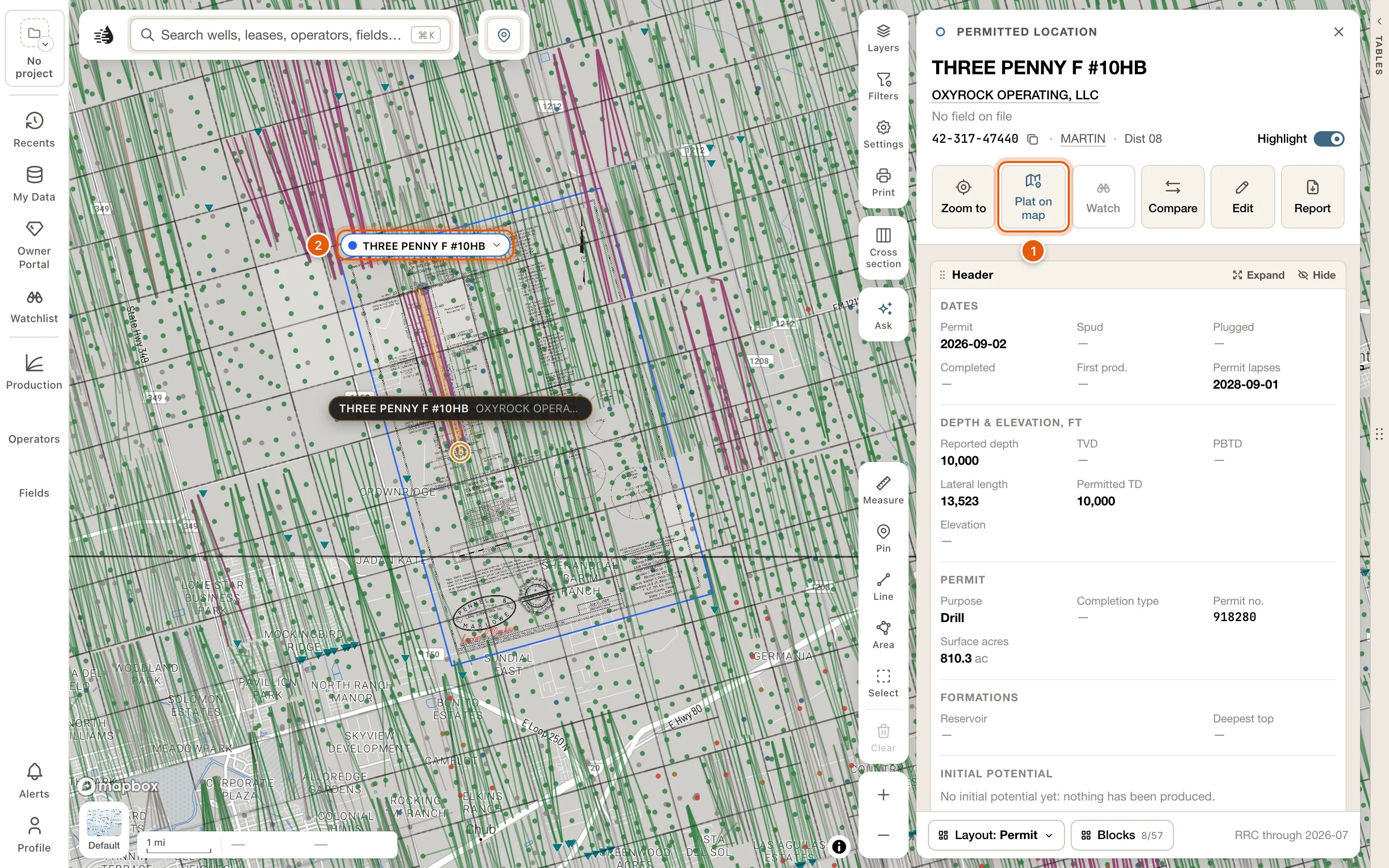
3
Read it on the map
The plat lies over the map where the surveyor drew it. Zoom in to about 14 to read its lettering. The plat doesn’t take clicks, so the wells under it still open.
From the well’s documents
The Filings & documents block of a well’s card has a MAP column on a plat’s row. A permit’s card shows the block from the start. On a producing well’s card it’s off at first: click Blocks and tick Filings & documents.- On map lays that plat on the map, and stays pressed while it’s there. Another click takes it off.
- Placing… shows while it’s being drawn, and Failed if it couldn’t be.
- Not placed means the plat couldn’t be placed. Hover it to see why.
On the map
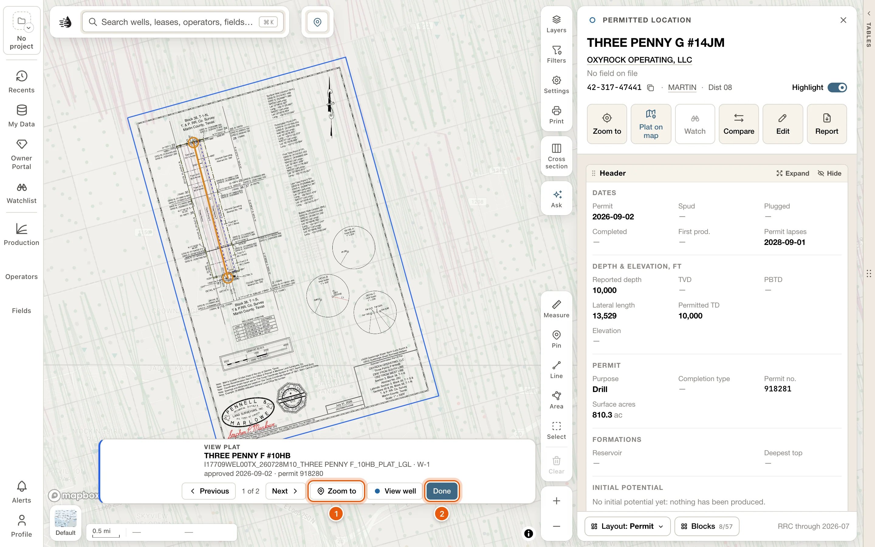
Each plat on the map has a tag at its top-left corner with its name, in the plat’s own color. Hover the tag to outline the plat. Click it for:- View plat: the plat and its well, with the rest of the map veiled.
- Zoom to frames the whole plat.
- View well opens the permitted well’s card.
- Opacity: how strongly the plat shows.
- Remove takes the plat off the map.
In the Layers card
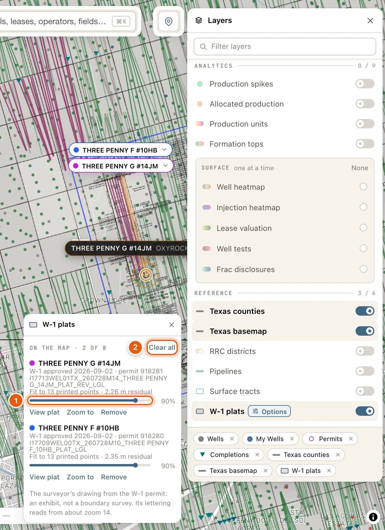
Click Layers on the right side of the map. W-1 plats, under REFERENCE, shows or hides all your plats at once. Switching it off keeps your list; adding a plat switches it on. With the row on, click Options beside its name for the list of your plats:- ON THE MAP · N OF 8, and Clear all, which takes every plat off the map.
- Each plat, the last one you added first: its name, its W-1 date and permit number, its sheet, and how closely it fits the printed coordinates, such as Fit to 4 printed points · 0.14 m residual.
- An opacity slider, and View plat, Zoom to and Remove.
Limits and saving
- Up to 8 plats can be on the map at once. Adding a ninth is refused: The map holds 8 plats at most. Remove one in Layers → W-1 plats to add this one.
- Your plats, and how strongly each shows, are remembered for your account and project. They’re still there after a reload and on another computer.
- A plat is a permit exhibit, not a boundary survey.
Troubleshooting
Add plat is greyed out
Add plat is greyed out
Hover it to see why:
- No W-1 plat is on file for this well. Plats are on file for permits approved since mid-2020.
- One plat is filed for this well, but it … gives the reason, such as a scan — scans are not placed yet, or could not be placed from what is printed on it.
- Looking for this well’s W-1 plats…: wait a moment.
I can't read the plat
I can't read the plat
Zoom in to about 14, where its lettering is readable, and raise its opacity in its tag’s menu or in Layers → W-1 plats.
Nothing shows after Plat on map
Nothing shows after Plat on map
Check that W-1 plats is switched on in Layers. If the plat is off screen, click Zoom to beside it in Layers → W-1 plats.