

One lease
Open the lease’s card. In its Lease record block, use Production or Wells, beside Export.
Many wells, leases, operators or fields
Open the data tables, narrow them down, and click Export.
Everything in an area or a county
Click Export on a Selected area card or a county’s card, pick the files, and download them in one zip.
All of an operator's, a field's or a county's wells
Click Show wells on its card, then Export on the tab that opens.
A production chart
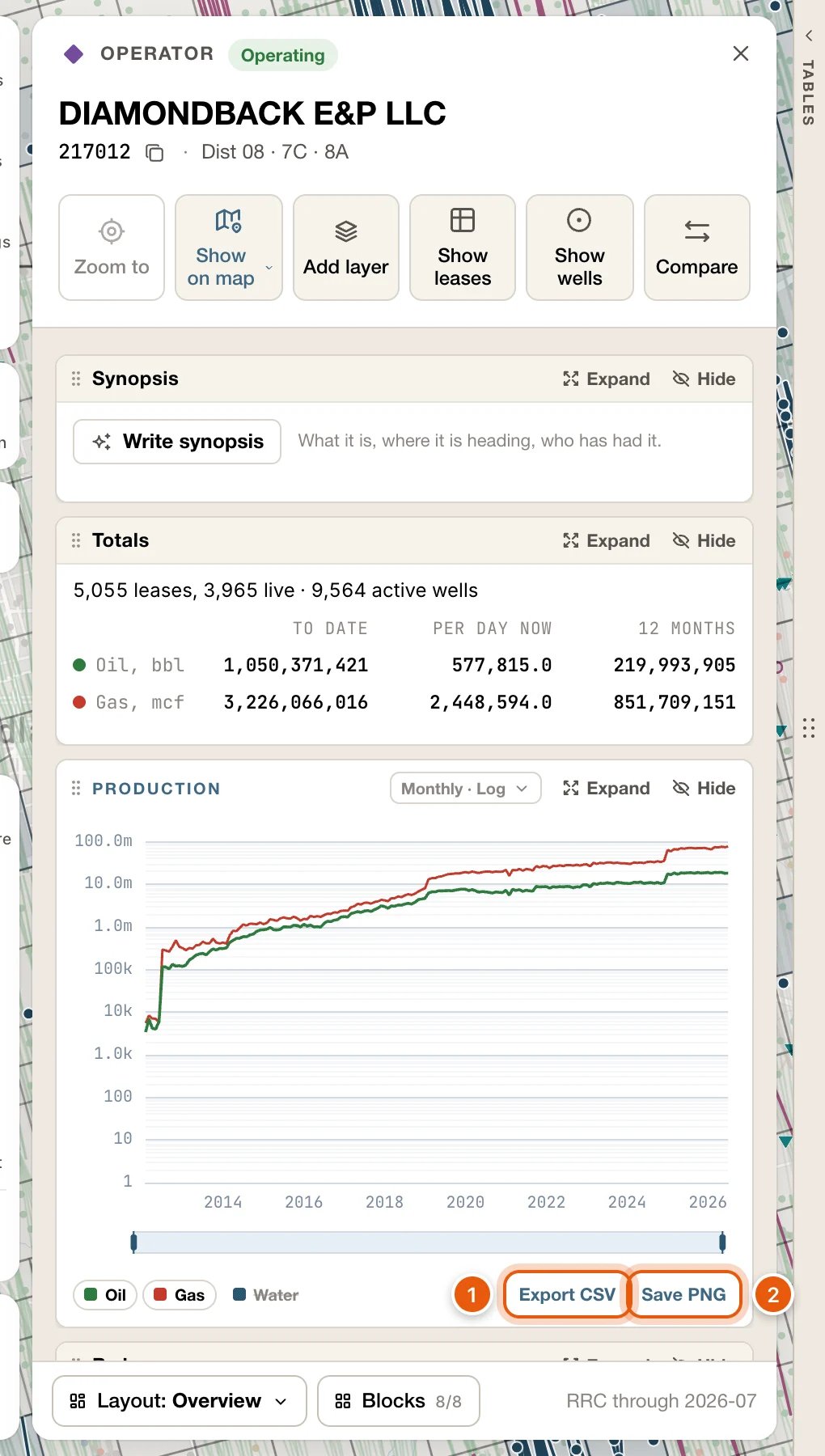
Use Export CSV or Save PNG at the foot of a card’s Production block.
Find your export
Looking for something else, like your own wells or layers, what’s producing in view, or your own properties? See More places to export.
Export one lease
1
Open the lease's card
Search for the lease by name and click it, or click the lease’s name in a well’s popup. You can also click a production spike on the map, or a row in the Leases table.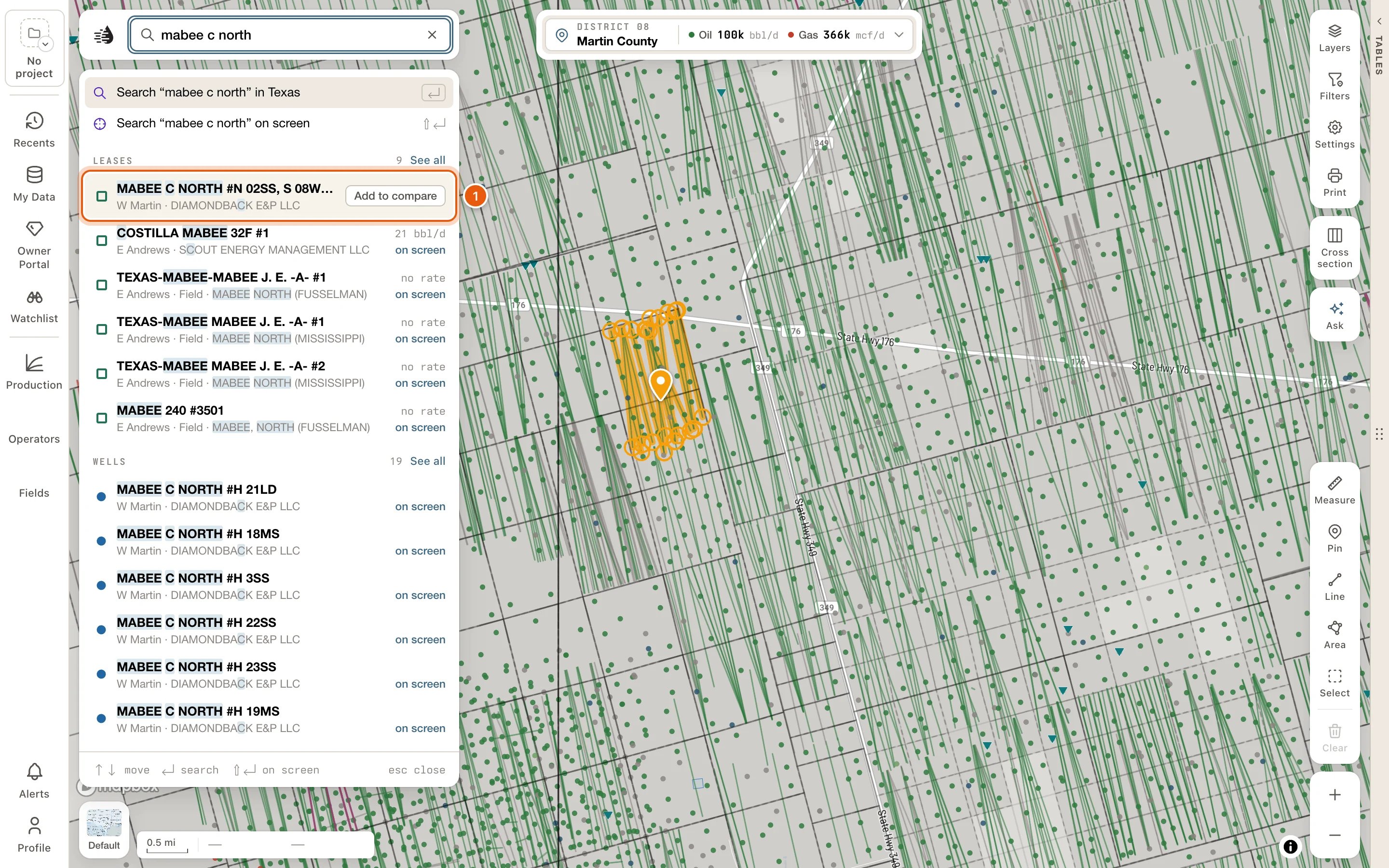
2
Find Export in the Lease record block
Scroll the card to the Lease record block. At its foot, beside Export, are two buttons: Production and Wells.If the block isn’t on the card, choose the Overview layout, or add Lease record from Blocks.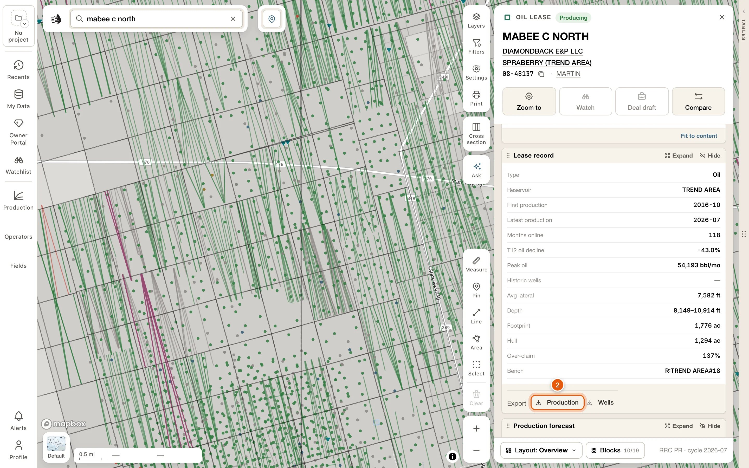
3
Pick a format
Click Production or Wells, then a format. The line under each format says what this lease would give you, such as 40 wells — well headers.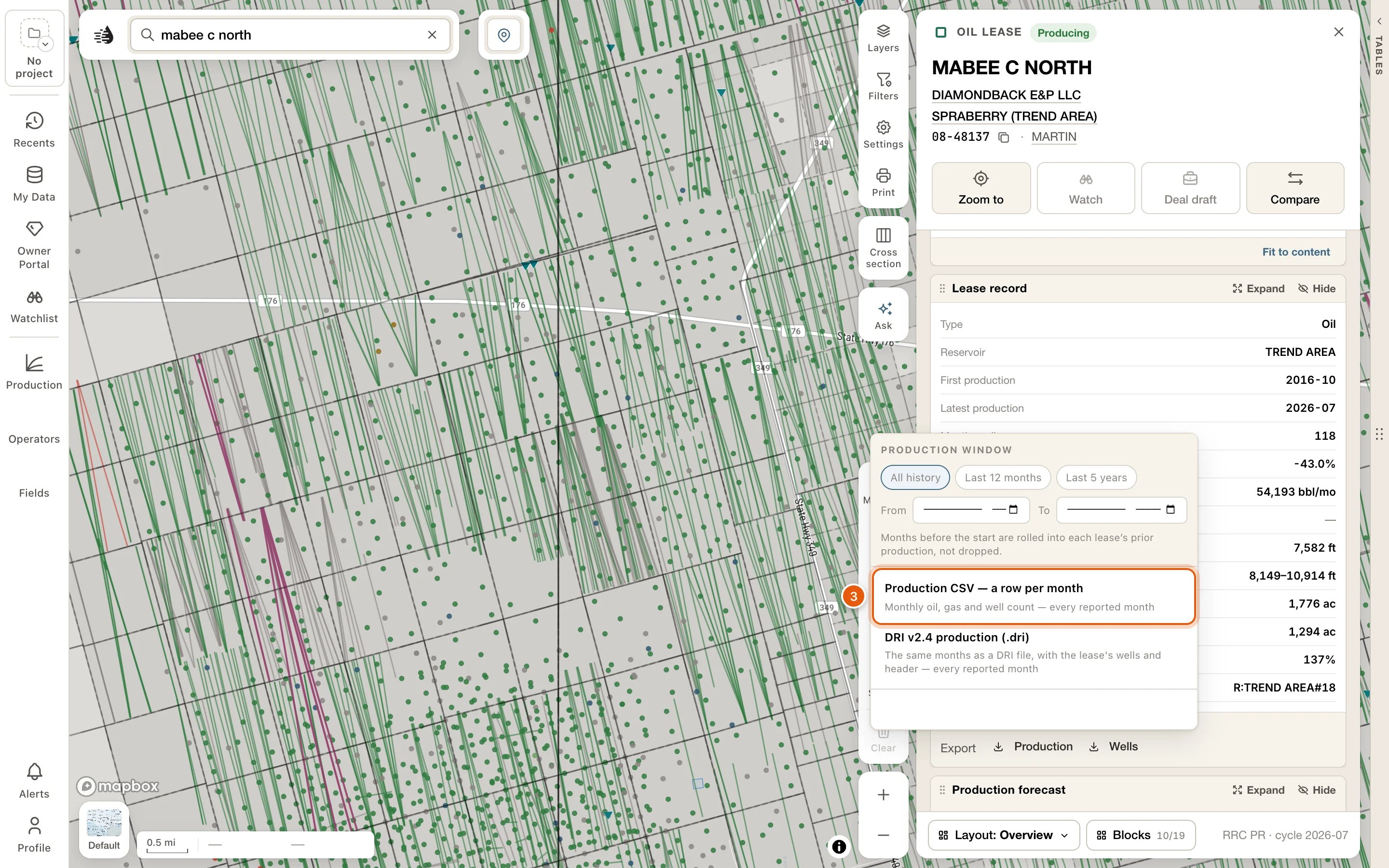
4
Check what was written
The file downloads. A line at the bottom of the menu confirms it, for example Production CSV written — 247 months, every reported month.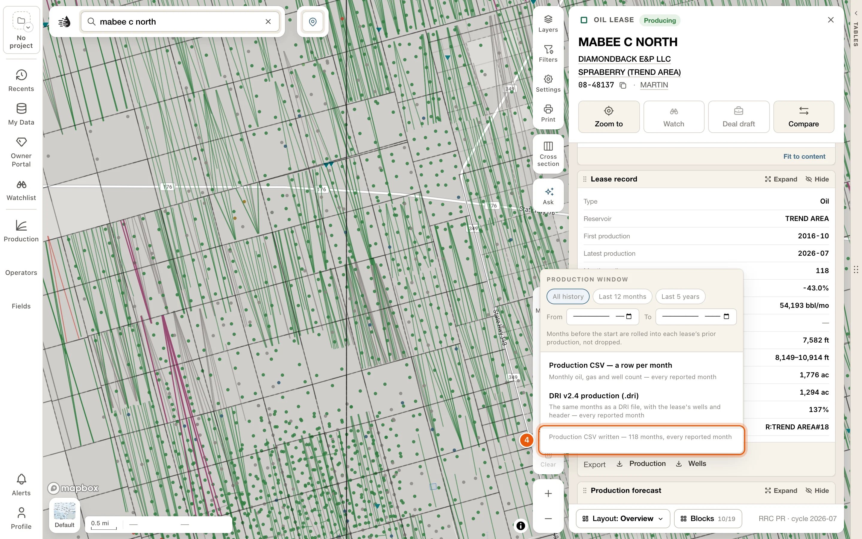
Production
Set the Production window at the top of the menu first, if you don’t want every month.
Wells
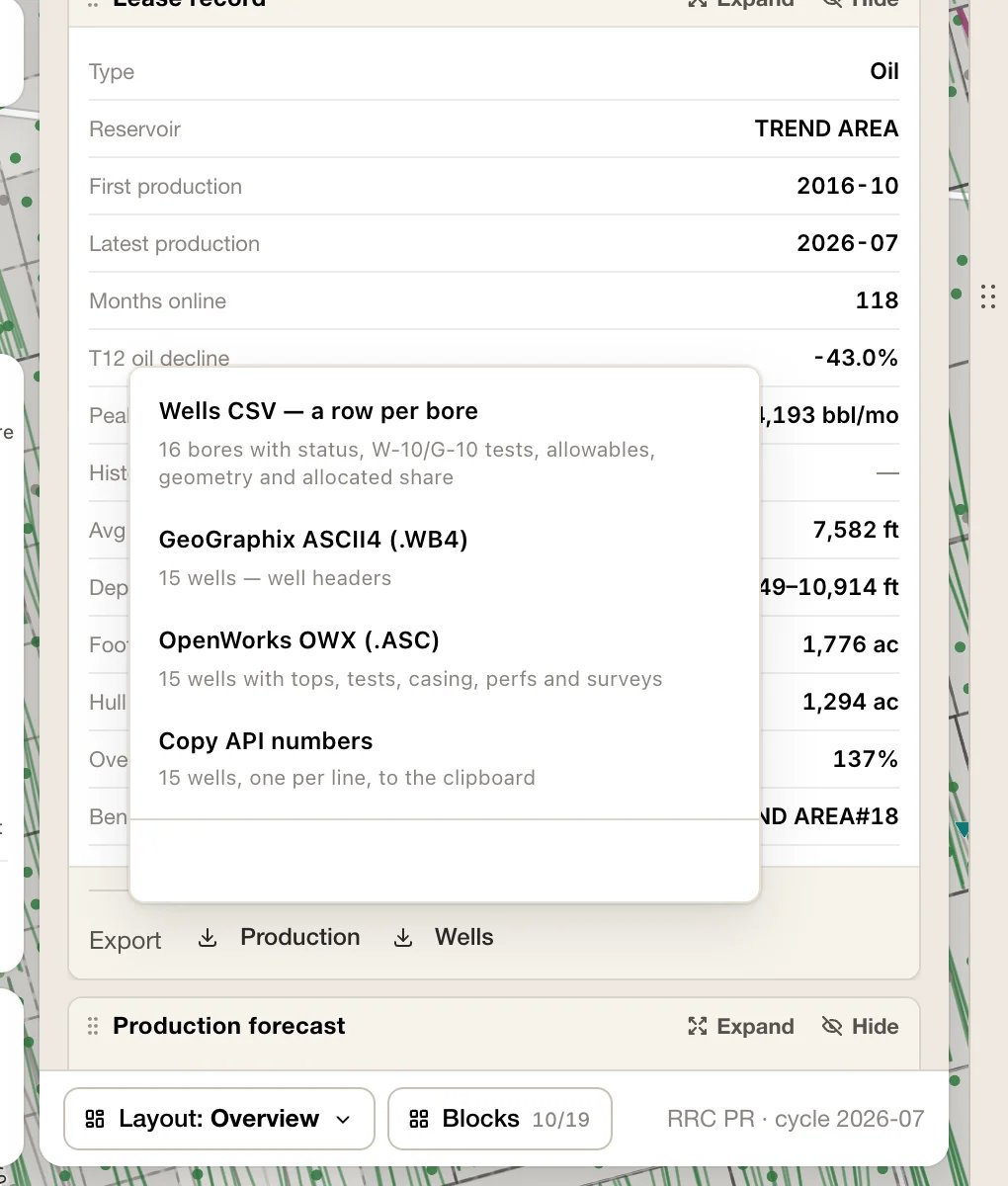
The first time you open Wells, QuickScout reads the lease’s wells. On a big lease the options stay greyed out for a moment and show how far along it is (Reading the lease’s wells — 120 of 400).
Historic wells are left out of ASCII4, OWX and Copy API numbers, because their API codes are shared between wells. The confirmation line tells you how many were left out. Wells CSV includes every bore.
The lease’s Production block has two more downloads at its foot: Export CSV and Save PNG. See From a card’s chart.
By well
The lease’s production split between its wells is an estimate, because Texas reports production by lease. To download it, Expand the lease card’s Production block, choose By well, then Export → By well CSV · monthly (estimate). The file has every well’s estimated production, month by month. See By well.Valuation and cash flow
Full valuation, in the lease card’s Valuation & EUR block, opens the lease’s full valuation report. Export, at the top of the report, has:
Export is greyed out until the report has loaded. The two CSVs stay greyed out when the lease has no production forecast (CSV needs a production forecast; this lease has none.). The PDF still works.
In the report’s Wells section, Download all N wells (CSV) has every wellbore on the lease.
Export from the data tables
1
Open the data tables and pick a tab
Click the Tables handle on the map’s right edge, then Wells, Leases, Operators, Fields or another tab. Frac, Pads and Rigs aren’t shown at first: add them with Add tab at the end of the tab row. See Data tables.
2
Narrow the rows to what you want
Use Filters, the tab’s filter box, and Scope. In view lists only what’s on the map. All lists everything your filters match, on the map or off it.The footer tells you how many rows you have, for example 1–39 of 578 leases. That’s what an export will carry.
3
Optional: tick just the rows you want
With rows ticked, every export carries only those rows.
4
Click Export and pick a format
Export is at the top right of the tables, beside Full screen. On a narrow panel it moves to a second line, under the tabs. Each option says what it will export: 578 leases × 19 columns — this view, built here, or 3 selected when rows are ticked.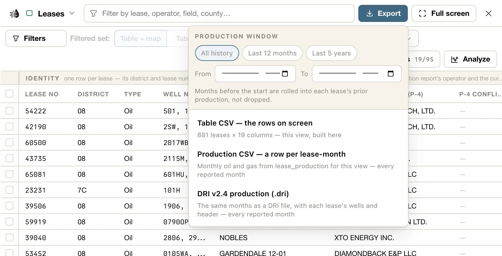
5
Watch the footer
While a file is written, and once it’s done, the table footer says so. A big file is written in batches, and the footer counts them off, such as Writing OWX — 500 of 8,627 wells, with Cancel.
Wells tab
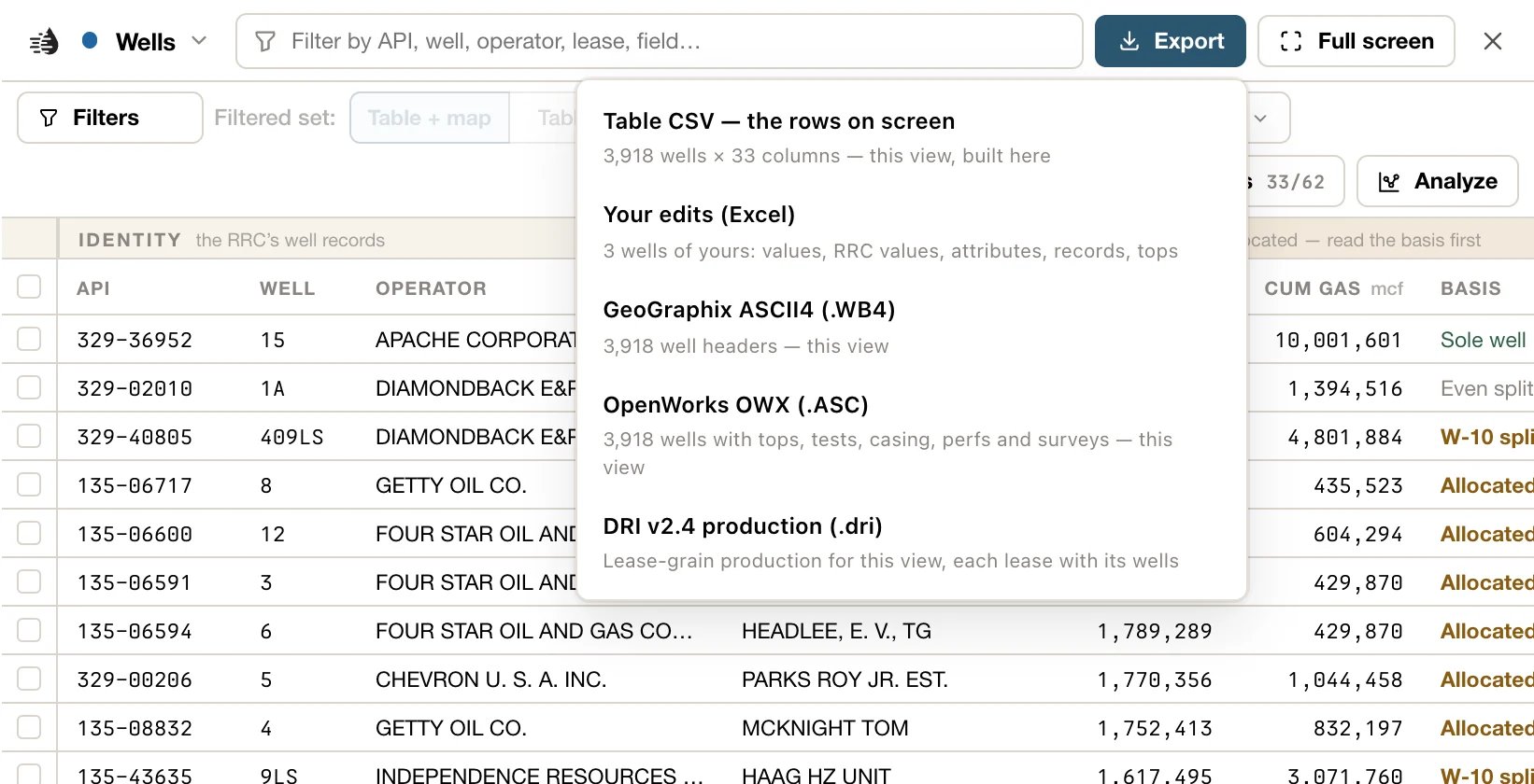
There’s no limit on how many wells a file holds. A big ASCII4, OWX or DRI file is written in batches and put together as one file, while the footer counts the batches off; Cancel stops it, and nothing is saved. OWX takes longest: thousands of wells take several minutes. If the server can’t write a well even on its own, the file leaves it out, and the footer names it.
OWX and DRI files leave out historic wells, whose API codes are shared.
Leases tab
There’s no limit on how many leases, either. The production is read in batches, and the footer counts them off (Reading production — 300 of 1,204 leases), with Cancel.
Operators and Fields tabs
These tabs export Table CSV — the rows on screen: one row per operator, or per field, with the columns you have showing. There’s no limit. For the leases or wells behind them, open a row’s card and click Show leases or Show wells. They open in a tab of their own, where the Leases or Wells formats are ready. See An operator’s, a field’s or a county’s wells and leases.P-4, Frac, Pads and Rigs
These tabs export Table CSV — the rows on screen. On P-4, Rows chooses whether the file has a row per Transfers event or per Filings.Shortcuts for ticked rows
Tick rows and a bar opens under the rows, just above the table’s footer. It has the exports you’ll use most, and copies the rows’ IDs: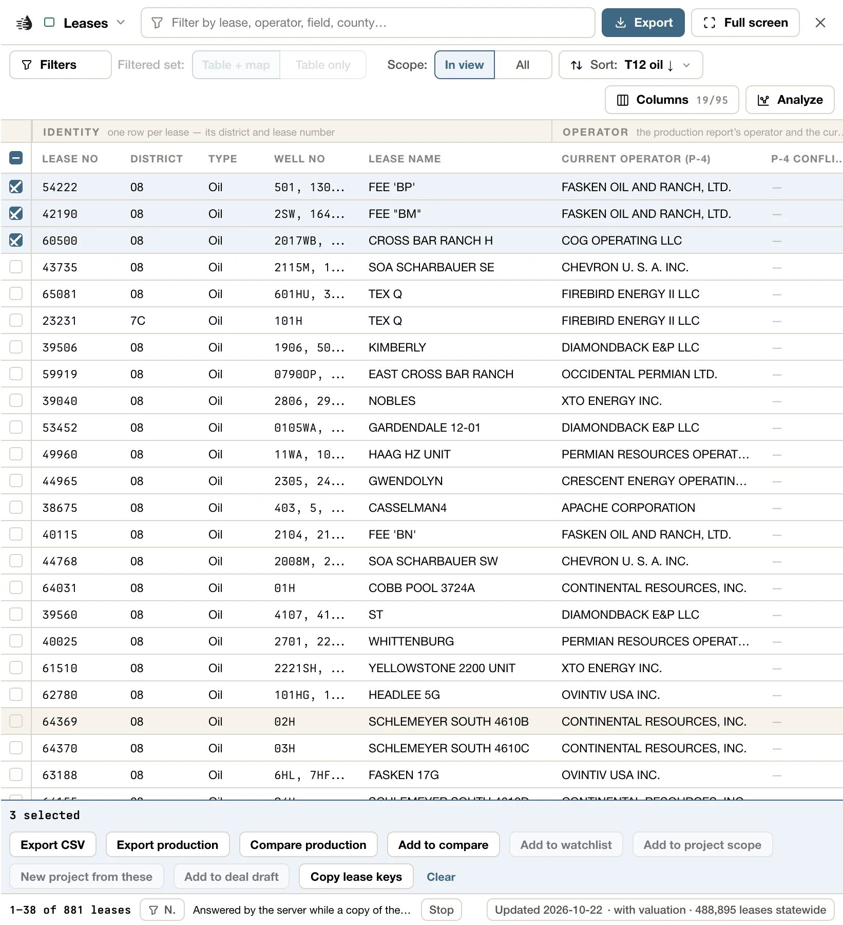
Copied IDs go on your clipboard one per line. Clear, at the end of the bar, unticks everything. On Wells, Leases, Operators and Fields, the bar also has Add to compare; see Compare.
You can also tick rows from a chart: drag across a scatter, or click a bar.
Export an area or a county
The Selected area card and every county’s card have Export. It writes what you pick about the area or the county as files for your own software, all in one zip: its wells, their production, the land grid, its leases, its outline and its tables.1
Open the card
Select an area of the map, or open a county’s card: click the place control (📍) at the top of the map, then View county. See Counties.
2
Click Export
Export is among the buttons under the card’s name. The Export card opens under it, with each kind of data on a row of its own and how many there are, such as 970 wells or 450 leases.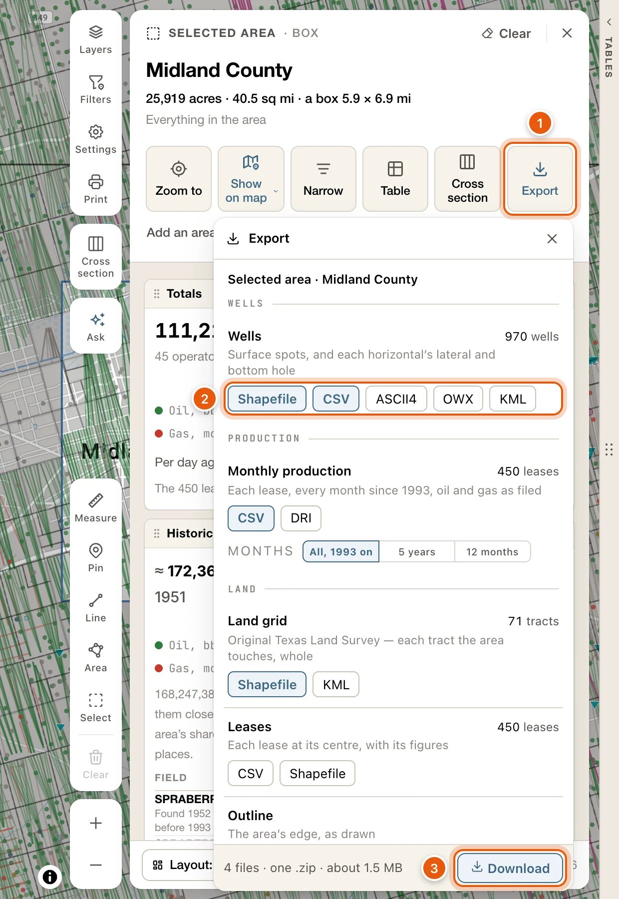
3
Pick the formats on each row
Each row has a button for every format it can be written in. Press the ones you want, and press one again to drop it. A row with none pressed isn’t written. Point at a format to see which software it’s for.The first time, Wells is pressed as Shapefile and CSV, Monthly production as CSV, and the Land grid as Shapefile. Your choice is kept for the next area or county you export.
4
Click Download
The foot says how many files you’ll get and about how big the zip will be, such as 4 files · one .zip · about 1.5 MB. Click Download.
What goes in follows the card. A narrowed selection exports the wells you narrowed it to, and their leases. The land grid and the outline are always the whole area’s. In a county, a lease that crosses the county line is exported whole, so its leases can add up to more than the county’s own figures on its card.
While it’s written
- Each format you pressed shows how it’s going: a tick when its file is written, a spinner while it’s being written, a cross if it failed. The foot counts off the work, such as Writing OWX — 3,000 of 24,512 wells · file 3 of 5, with Cancel.
- You can close the Export card, or the area’s card, and keep working. A row at the bottom of the map says Exporting ‹name› and how far along it is. Open brings the Export card back, and Cancel stops the export.
- One export runs at a time. Another Export card says so while one is running, with Cancel it.
- When it’s done, the zip downloads, and the foot reads Saved with its name and size. Save again saves it once more, in case your browser didn’t finish the download. Done closes the card.
- If a file can’t be written, the export stops and says which file and why, such as Monthly production (CSV) could not be written. The files written so far are kept, and Retry carries on from the file that failed.
- A record the server can’t write, even on its own, is left out of that file. The foot names how many, and the README lists them.
- An export of a gigabyte or more asks once more before it starts: Download anyway, or Back. A zip can hold up to 4 GB; past that, the export says so, and you drop a format or two (OWX and the CSVs are the largest) and download again.
What’s in the zip
- The zip is named for the area or the county and the day, such as
midland-county-2026-10-24.zip. If you pick just one file, and it isn’t a shapefile, it downloads on its own instead. README.txtsays what each file holds and where it came from, how the area was drawn or narrowed, which coordinates each file uses, and what the short field names in the shapefiles mean.- Shapefiles are NAD27, the datum the RRC files well spots and the land survey in, and each has its
.prj. KML is WGS84, for Google Earth. The wells CSV has the app’s WGS84 coordinates and NAD27 ones beside them. ASCII4 and DRI carry the RRC’s NAD27 points as filed, and OWX is WGS84. - NAD27 and WGS84 positions of the same point are 36 to 44 m apart in West Texas, so tell your software which datum each file is in.
- ASCII4 and OWX carry the RRC’s wells. Your My Wells edits are in the shapefile and the CSV. The card reminds you when you press either one.
- Wells from old maps have no API number, so they’re in the shapefile and the CSV only. With ASCII4 or OWX pressed, the card says how many there are.
From a card’s chart
Open a lease, operator, field, county, P-4 or frac card, or the card of an area you selected. Its Production block has two buttons at its foot:- Export CSV: one row per month, with
month,oil_bbl,gas_mcf,water_bbl,reportedandbasis.basissays whether the month is the lease’s reported figure or an allocated estimate. The file has every month, whichever way the chart is set to show them. - Save PNG: the chart as you see it.
month, inj_bbl, inj_mcf, avg_inj_pressure_psi and max_inj_pressure_psi.
Export an operator, a field or a county
The production chart
An operator’s, a field’s and a county’s card each have a Production block, with the same Export CSV and Save PNG at its foot as a lease’s. See From a card’s chart. To open a county’s card, click the place control (📍) at the top centre of the map, then View county. You can also click the county on a well’s or a lease’s card. See Counties.An operator’s, a field’s or a county’s wells and leases
Open the operator’s, the field’s or the county’s card and click Show wells. Every one of its wells opens in a tab of its own, the Record tab. Click Export, at the top right of the tables, for the same formats as the Wells tab.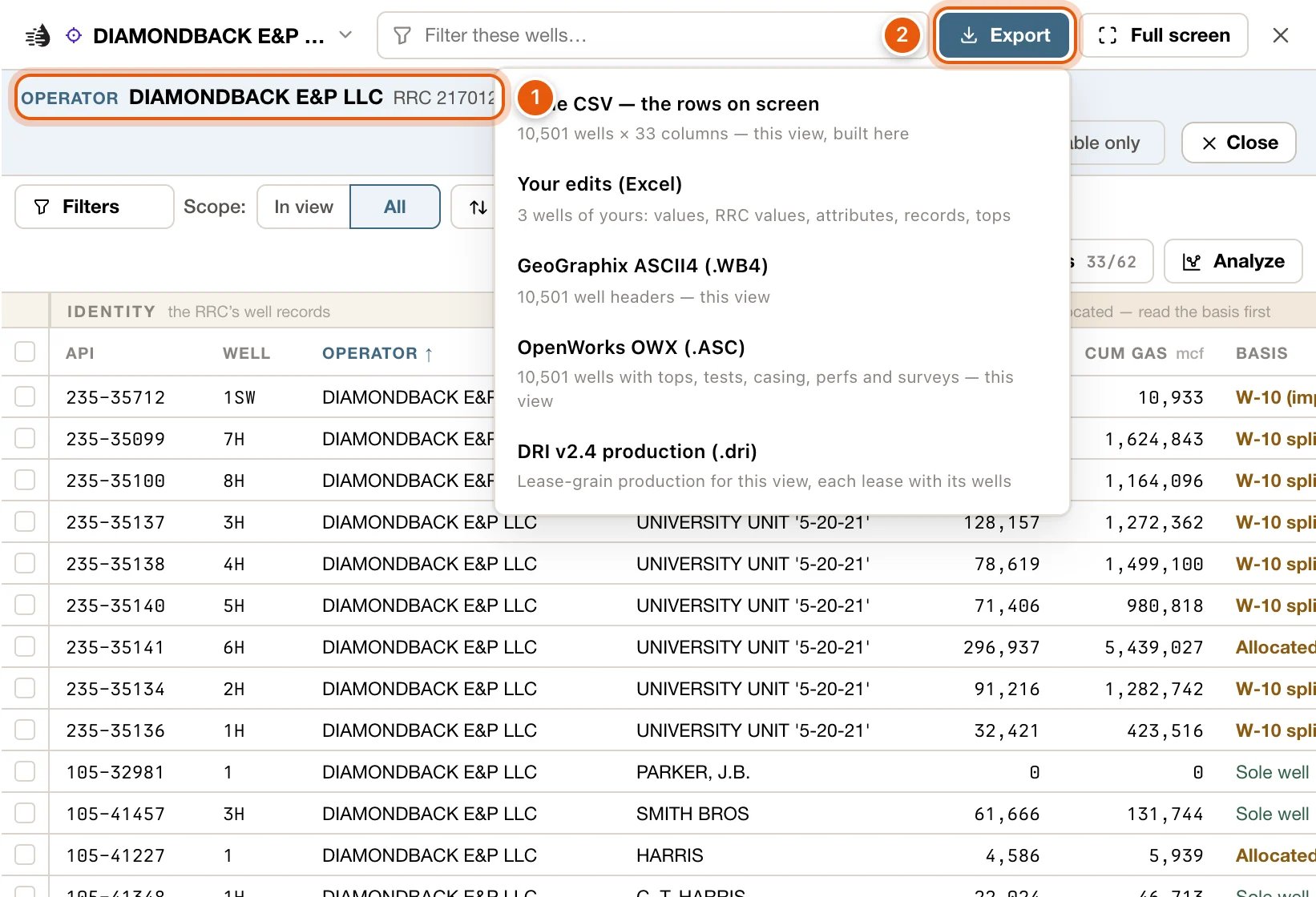
- Show leases opens the record’s leases instead, with the Leases tab formats, including Production CSV — a row per lease-month and DRI v2.4 production (.dri). Rows switches between the two.
- The tab starts on the whole record. If you set Scope to In view, the export carries only what’s in view.
- Your own Wells and Leases tabs and their filters stay as they are, and the card stays open.
Well documents
On a well’s card, the Filings & documents block lists the well’s permits, plats, completions and surveys. A permit’s card shows it from the start. On other wells it’s off at first: add it from Blocks, or click More → Documents in the well’s popup, which opens the card with the block showing.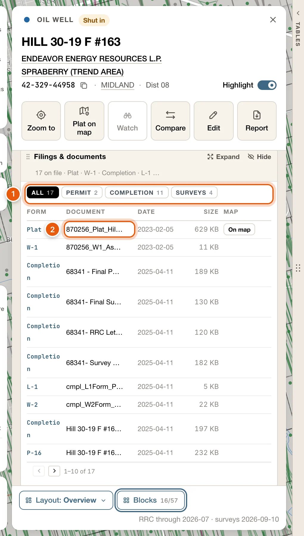
- When the well has more than one kind of document, chips filter the list, each with a count: All, Permit, Completion and Surveys.
- Each row shows the Form, the Document, its Date and Size. Click a document to open it in a new tab, where you can save it.
- A Map column appears when one of the well’s plats can be laid over the map. See W-1 plats on the map.
Well logs
Logs open in the Log tab beside the map. When a log opens in its drawer instead, Open log opens the original file, a scan or a LAS file, in a new browser tab, where you can save it. Open the scan does the same for a log’s scanned copy. See Well logs on the map.Choose the months
The production exports have a Production window at the top of the menu:- All history, Last 12 months or Last 5 years.
- Or set your own range with From and To.
Operators report production to the RRC two to four months behind. The last few months of any window are usually empty.
What the files contain
CSV files are made to open cleanly in Excel, a database or a GIS:- The header row uses column keys, such as
cum_oil_bbl, not the on-screen labels. - Numbers are plain:
1234, not1,234. A blank cell means there’s no value. - When a Wells CSV has a cumulative in it,
cum_basiscomes with it, even if you’ve hidden that column. It says how the per-well figure was worked out. The RRC reports oil by lease, so many per-well cumulatives are allocated. - The file name says what’s inside: the table, the place you’re looking at, the date, and the table’s row count. For example,
wells-midland-county-2026-09-19-3885-rows.csv. The count is the whole view’s, even when you exported ticked rows. A Production CSV’s count is its monthly rows.
district_name, lease_no, lease_name, month, oil_bbl, gas_mcf, wells, lateral_ft and months_online.
GeoGraphix ASCII4 (.WB4), OpenWorks OWX (.ASC) and DRI v2.4 production (.dri) are import files for other software. Load them with that program’s own import tool.
Troubleshooting
I can't find the Frac, Pads or Rigs tab
I can't find the Frac, Pads or Rigs tab
They aren’t shown at first. Click Add tab at the end of the tab row and pick one.
An option is greyed out
An option is greyed out
The line under the option says why:
- Nothing to export, or every option greyed: the table has no rows. Loosen your filters, or switch Scope to All.
- The production window runs backwards: the From month is after the To month.
- Reading the lease’s wells…: wait a moment. A big lease takes a few seconds.
- No wells on record for this lease: there’s nothing to put in a wells file. The production exports still work.
- CSV needs a production forecast: the lease’s valuation has no forecast. Report (PDF) still works.
The file has fewer wells than I expected
The file has fewer wells than I expected
- Historic wells are left out of OWX and DRI files, and out of a lease’s ASCII4 file.
- Check Scope. In view exports only what’s on the map; All exports everything your filters match.
- Check whether rows are ticked. With rows ticked, exports carry only those rows. Clear unticks them.
- In an area’s or a county’s ASCII4 and OWX files, wells from old maps are left out, because they have no API number. They’re in its shapefile and CSV.
- A well the server couldn’t write, even on its own, is left out and named: in the table’s footer, or on the Export card and in the zip’s
README.txt.
An area's export stopped
An area's export stopped
The Export card says which file couldn’t be written and why. The files written so far are kept: click Retry to carry on from the file that failed. If you closed the card, the row at the bottom of the map says The export of ‹name› stopped, with Open and Retry.If it says the files are past the 4 GB a single zip can hold, drop a format or two (OWX and the CSVs are the largest) and download again.
A column is missing from my CSV
A column is missing from my CSV
Table CSV exports the columns you have showing. Open Columns, tick what you need (or pick one of the Views), and export again.
It says no production is reported
It says no production is reported
The lease reported nothing in the window you chose. Widen the Production window, or choose All history.
It says Sign in to export
It says Sign in to export
Your session has ended. Sign in again, then export.